Turning Marginal Acres into Profit: The Power of Buffer Strips
January 21, 2026
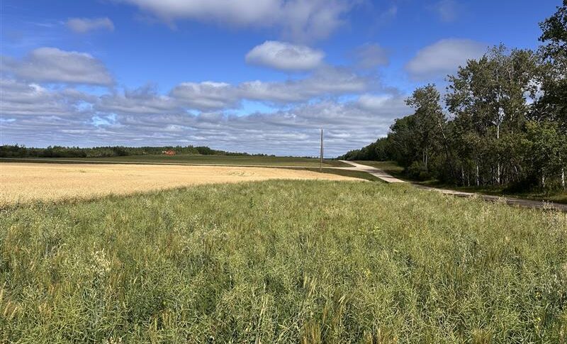
Across the Canadian Prairies, the Great Plains of America, and the American Corn Belt, many growers face a common challenge: unprofitable acres that continually reduce ROI and farm profitability. These areas often feature uneven terrain, low spots, washouts, and low-fertility soils, creating management headaches for producers. A conservation practice that is gaining traction to help alleviate these pain points for growers are buffer strips. It is important to note that a buffer strip/area are not the same as a marginal area. While marginal land is a designation that describes poor-performing portions of previously farmed fields, a buffer strip is a conservation practice implemented on acres that are often marginal in nature.
These buffer strips aren’t just about protecting waterways; they’re a smart investment on the farm. By establishing strategic species in sensitive management areas, growers can boost ROI by turning unproductive acres into assets. Additionally, some municipalities enforce strict guidelines on buffer strip placement under shoreland management and drainage laws, so understanding local regulations is important.
The main ecological goals of enhancing buffer areas include improving soil fertility, safeguarding water quality, reducing erosion, stabilizing waterways, and enhancing wildlife habitat. It’s a single practice with big payoffs for both farm profitability and sustainability. Buffer strips also play a critical role in protecting vulnerable areas, such as organic production, where preventing contamination from conventional practices is essential. In short, effective buffers intercept overland water flow and protect vulnerable areas in both conventional and organic systems alike.
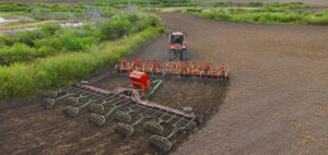
Different buffer strips are very similar in concept, but exactly where and how they are implemented varies, depending on the type of operation and goals for the specified implementation area. There are several types of buffer strips as described by the United States Natural Resources Conservation Service (NRCS) to figure out the where:
• Field borders are strips of permanent vegetation established on one or more sides of the inside perimeter of a field. A mix of grasses, legumes, forbs, or shrubs, field borders are designed to be multi-purpose to reduce erosion, sediment runoff, wildlife/pollinator habitat, and more.
• Contour buffer strips are strips of perennial grasses and/or legumes alternated with wider cultivated strips that are farmed on the contour of hills. This type of buffer is common in systems where sloping farmland is present, mostly in horticultural settings.
• Riparian forest buffers are established by planting trees and shrubs along waterways and water bodies that aid in repairing diversity, structure, and composition of young riparian plant communities. It also helps to reduce the transport of contaminants such as sediment and pesticides into surface water and groundwater.
• Filter strips are areas of grass and other native vegetation planted adjacent to streams, wetlands, lakes, and ponds to protect water quality. This type of vegetation serves as a natural filter to assist in stabilizing cropland susceptible to wind and water erosion.
No matter which type of buffer strip fits best, there are several steps to take when considering how to make it happen on your operation:
Step 1: Area Assessment
Consider unique features of potential buffer areas (soil type, topography, water flow, etc.).
Create a simple map to visualize boundaries, important points, and possible issues.
Step 2: Define Your Goals
Identify the primary purpose of your buffer strip (erosion control, wildlife habitat, nutrient filtration, etc.).
Focus on measurable objectives for success.
Step 3: Design Your Plan
Select a location based on field conditions and goals.
Determine potential buffer strip size and needs for seeding.
Step 4: Select Plant Species
Research plants that are in line with your goals.
Ensure that species will establish in the soil conditions present in your desired location.
Step 5: Monitor & Evaluate
Track establishment progress.
Observe changes in soil, water quality, field ROI, wildlife presence, etc.
To help you more critically think about what these steps may mean and look like for you, we have included a few resources that we feel should be helpful in exploring buffer strips further:
Canadian Resources:
Field Manual on Buffer Design for the Canadian Prairies
This is an in-depth tool to address assessing buffer needs on a site-by-site basis to identify where zones should be placed.
United States Resources:
Conservation Buffers | Center for Regenerative Agriculture
The University of Missouri Center for Regenerative Agriculture has great resources on buffer strips. This content is great to learn more about the benefits of buffers and additional items to consider as you consider implementation.
Buffer Strip Design, Establishment, and Maintenance
Iowa State University has resources available on buffer strip implementation.
Check in with your local NRCS office
The NRCS has many in-house resources and often funding. Their staff is happy to assist you.